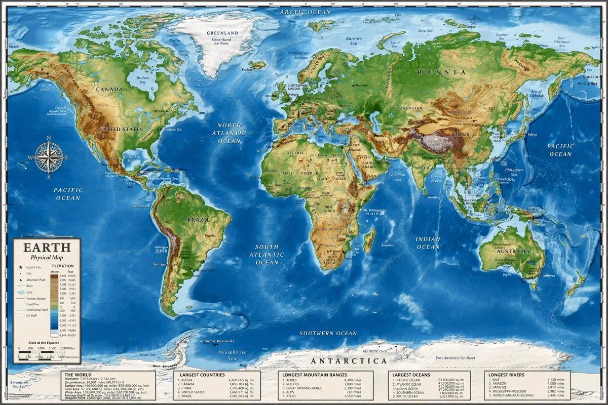
Detailed Physical World Map with Info Panels
"type": "highly detailed cartographic world map", "style": "argument name=\"color palette\" default=\"realistic topographical and bathymetric colors\"", "map_features": "terrain": "shaded relief showing mountains, valleys, and plains in greens, browns, and whites", "oceans": "depth shading in various tones of blue, with lighter blues for continental shelves and darker blues for deep trenches", "grid": "latitude and longitude lines spanning the entire map", "labels": "major continents, countries, oceans, and seas clearly labeled in serif and sans-serif typography" , "layout": "overlays": [ "type": "compass rose", "position": "mid-left, over the Pacific Ocean", "description": "classic 8-point nautical compass" , "type": "legend", "position": "bottom left", "title": "argument name=\"map title\" default=\"EARTH\"", "subtitle": "argument name=\"map type\" default=\"Physical Map\"", "contents": "elevation color key, map symbols, and distance scale" ], "bottom_panels": "count": 5, "position": "horizontal row along the bottom edge", "labels": [ "THE WORLD", "LARGEST COUNTRIES", "LONGEST MOUNTAIN RANGES", "LARGEST OCEANS", "LONGEST RIVERS" ]