Tell us anything

An idea, a bug, something you love. We read every note.

⌘↵ to send. The page you're on comes along.

Report
Back

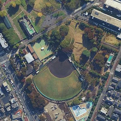
Cartoon drone-style Google Maps aerial illustration prompt

LS
Library Social
9 hours ago
Report

Transform this aerial map view into an illustrated aerial photograph captured from above. Create a vibrant, animated aesthetic with brilliant colors and scatter miniature figures throughout the scene for a whimsical, magazine-quality illustrated result.

Report this post

Anonymous: Library Social won't see who reported it

What's wrong?
More options
Pick a reason

Shortcuts

Anywhere

Search
/
Search (Ctrl K on Windows)
⌘K
New post
N
Fold the sidebar
[
Shortcuts
?
Close
Esc

Go to

For You
GthenH
Explore
GthenE
Saved
GthenS
Activity
GthenA